View on Google Maps
Along the Urumea river
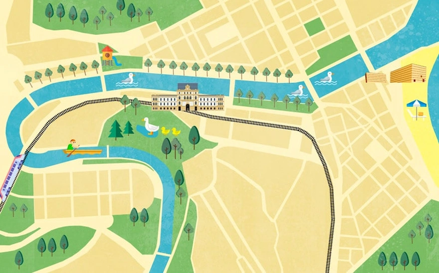
It’s always pleasant to walk along the river! The path by the Urumea is flat and comfortable, where a gentle breeze usually blows, passing by stately buildings with the flowing water accompanying you throughout the walk…
Distancia: 3.86 Km
Paradas: 11 stops
Tiempo: 45 min.
1
2
3
4
5
6
7
8
9
10
11
Mouth of the Urumea
We’ll begin our walk on the esplanade next to the Kursaal building, right where the breakwater begins. If we face the sea, to our left we’ll see the Urumea river flowing into the Cantabrian Sea, with Mount Urgull behind it.
Long ago, Urgull was another small island that shared the spotlight with Santa Clara in the bay. The Bay of La Concha stretched from Igeldo to Ulia, and the Urumea river flowed into it, creating extensive wetlands (where we’re standing now would have been underwater…). Both Santa Clara and Urgull were islands within this bay. Later, the river’s mouth shifted eastward due to the formation of a sandy tombolo that connected Urgull to the mainland, turning it into a peninsula. This changed the bay’s relationship with the Urumea river, giving it its current shell-like shape with Santa Clara Island as its central feature. Today, the original dune and marsh environments have completely disappeared beneath the city’s urban structure.
Looking to the east, we see Zurriola Beach and Mount Ulia in the distance. This is the easternmost of the three mountains that make up San Sebastian’s skyline, along with Igeldo and Urgull. It’s also the least developed and has the greatest natural value. The proximity to the sea and sandy soil significantly influence the vegetation found here. Sea cliffs and small oak groves of Pyrenean oak and sessile oak – the area’s potential vegetation – have been displaced by introduced ornamental species.
The north-facing slope by the sea has very particular conditions: high salinity, strong ocean winds, and siliceous soil, meaning only well-adapted species can grow here. For this reason, Ulia’s cliffs are protected and included in the European Natura 2000 network as a Special Conservation Area. They harbor plant species found only in this environment, along with a variety of birds that nest in the cliff ledges.
No hay imagen
Zurriola Beach, which we see to our right at the foot of Ulia, is actually an artificial beach. The natural beach with its dune field was urbanized in the first half of the 20th century.
We’ll follow the river upstream along its course. We continue along Ramón María Lili street. Notice the trees along this riverside promenade – they might look familiar.
Tamarisks in Donostia
The tamarisk is a native tree, very easy to find in its natural state on sandy areas, dunes, sea cliffs and similar environments on the Basque coast due to its ability to withstand wind and high salt concentrations.
No hay imagen
It was in the early 20th century, thanks to Agapito Ponsol, a councillor at Donostia City Council, who discovered this tree during a trip to the French coast. Together with Pierre Ducasse, the municipal gardener at the time and creator, among others, of the gardens in Gipuzkoa Square and the Miramar and Aiete Palaces, they realised that it was a sturdy tree that could withstand inclement weather and salt, so they proposed planting it on La Concha Promenade.
Añade aquí tu texto…
Eagle on the Paseo Colón
When we reach the Santa Catalina bridge, we’ll leave the riverside to focus on the top of the majestic building that links the Paseo Colón with Calle Miracruz, where we can see two stone eagles crowning the roof. These birds of prey seem to be watching from above, waiting for the right moment to pounce on their prey. The best-known eagle sculpture in the city is the one in Centenario Square, but it’s not the only one in the city. (It seems that Gros has nothing to envy the city centre… it has a tamarisk promenade and, instead of one eagle, two).
No hay imagen
We continue on our way, deviating slightly from the Paseo Urumea towards Duque de Mandas, approaching the courthouse building. Right here, where the railway tracks pass overhead, we’re standing on top of some large underground water tanks.
Stormwater tanks
These are stormwater tanks. Huge underground reservoirs created to store the first rainwater, which is also the most polluting, as it washes away all the dirt accumulated on the streets and asphalt. In this way, the tanks prevent the treatment plants from exceeding their maximum flow and having to dump the excess untreated.
On days of heavy rainfall, water filters through the sewers, but because of its huge volume, it cannot be treated immediately.
That’s why this water waits in the stormwater tanks until the rain stops. It is then gradually channelled to the treatment plants. In this way, not only is river pollution avoided, but possible flooding and environmental damage are also prevented.
It’s part of the municipal sewerage network infrastructure, invisible to our eyes, but necessary for the proper functioning of the city.
No hay imagen
We return to the riverside, resuming our walk along the Paseo Urumea.
It won’t be difficult to spot some seagulls from here. Flying over the river, bathing in groups or taking advantage of the low tide to sunbathe on the rocks.
Seagulls
Seagulls are the most popular, most abundant and easiest seabirds to observe in ports, coasts and cliffs. They are opportunistic birds with a great capacity for adaptation. In recent years they have adapted to live in cities at the expense of waste and thanks to the shelter provided by towns and cities. They are colonial and live in large groups and, although they may appear disorderly and anarchic, they are perfectly organised. They are noisy and expressive, few groups of animals are noisier than a seagull colony, and they are very communicative both vocally and gesturally.
No hay imagen
They are also birds with a great capacity for learning, and decades of scientific studies have shown that they can learn, remember and even teach certain skills to other seagulls. They are monogamous, pairs are for life, although they may not live together all year round, and only pair up during the breeding season.
There are different species of seagulls which, although they may look physically similar, are not. Along with some more exotic species that may visit us occasionally, the most common in the Urumea are:
– Yellow-legged gull: This is the most common in Donostia. It stands out for its legs, which are indeed yellow.
– Black-headed gull: Smaller in size, it has red legs and beak. It has a black hood in the breeding season (spring-summer). The rest of the year, the adults lose the dark feathers on the hood, which are reduced to a small spot next to the eye.
– Lesser black-backed gull: It is very similar to the yellow-legged gull in terms of size and leg and beak colour. However, the plumage on its back is darker.
The María Cristina Bridge: Dragons and Horses
The Urumea holds great surprises, and not all the animals that live in its waters are real… or made of flesh and blood. We’ll go to the María Cristina Bridge to discover them.
This bridge, considered by many to be the most elegant of those that cross the Urumea, was built in 1904 by the engineer José Eugenio de Rivera and the architect Julio Zapata. Like many of the buildings built at that time (many of them between 1887-1929, when María Cristina spent her summers in San Sebastián), this bridge has a marked Parisian style influenced by the Belle Époque. In fact, the whole bridge is inspired by the Pont Alexandre III in Paris.
We must look up at the four obelisks to see the golden horses that crown them, rising towards the sky. The statues are made of cement and painted gold. In addition to the horses, this emblematic Donostiarra bridge has other magical animals, the protagonists of fairy tales and old legends, the dragons, which watch us pass by from the top of the lampposts or hidden in the railings.
No hay imagen
But these lifeless animals are not the only curious images we can find on this bridge. If you take a moment to look at its details, you’ll see that the railings and the ceramic on its arches are decorated with mythological and marine creatures, snakes, children, boats and, in general, various scenes related to a romantic maritime and naval imaginary.
Oysters
If we leave the station behind us, walk along the bridge on the right-hand pavement and almost at the end of it we look over the railing, we’ll see white mounds on the riverbed that at first glance look like stones or rubble. But they’re oysters. Bivalve molluscs perfectly adapted to intertidal zones, which feed by filtering seawater and trapping plankton and suspended particles. Tirelessly, they can filter up to five litres of water per hour.
No hay imagen
We return to the Paseo Urumea to continue walking along the right bank next to the river.
It’s obvious that in this last stretch the river is channelled, and the riverbed flows between stone walls that limit it on both sides. If we look at these walls that hold back the water, we’ll see that there is also life on them. Some very special plants live in their cracks.
Rock samphire
Rock samphire (Crithmum maritimum). It is a plant that is very well adapted to cracks and walls on the coast, because it doesn’t need much water as it stores it in its fleshy stems and leaves, and grows in stony, shallow soils. It is found on the front line exposed to winds laden with salt and splashes from the waves. It is called rock samphire because its inflorescences are very similar to those of common samphire.
In the past, sailors carried leaves of this plant preserved in brine with salt and vinegar on their long voyages, as in addition to preventing scurvy (due to its high vitamin C content) it also has purifying, digestive and diuretic properties. Its tender leaves are eaten in salads or preserved, and are also added to pickles and brines to give them their particular aroma.
Meander of Cristina Enea
When we reach the height of the Mikel Laboa footbridge that links the Riberas de Loiola neighbourhood with Cristina Enea Park, we’ll see that the buildings on the other bank give way to trees and plants. We’re looking at Cristina Enea Park.
No hay imagen
This former estate that belonged to the Dukes of Mandas, now an urban park, is located on a small hill created by the last meander of the Urumea river. The Dukes of Mandas chose these lands next to the Urumea, which at that time were on the outskirts of the city. To the first lands they bought from what was the Mundaiz estate, they added farmhouses, vegetable gardens and a tidal mill next to the river. They invested a good amount of money in buying all this, which meant that the estate was the perfect size for them to build their own paradise. As they acquired the land, the estate was designed according to the tastes of the time and of the couple. Paths, forests, trees, the pond… were the first things to be designed and built, before the palace or the service buildings. To do this, they hired the best architects and landscapers of the time, such as the gardener Lecour, the Parisian landscaper Georges Aumont or the very famous gardener Pierre Ducasse.
Continuing along the riverbank in this section, from Cristina Enea to the Quirón Clinic, during low tide the muddy banks of the river are exposed.
Cormorants and waders
We’re in the lower reaches of the Urumea, near its mouth. In this stretch where the water flows slowly and the gradient moderates, the river deposits sediment on its banks. This sediment, made up mainly of mud and sand, is where wading birds find their food, using their long, thin beaks to search for and catch invertebrates under the mud. They’re usually brown in colour to camouflage themselves in the mud, so it may take us a while to spot them at first glance, but if we look carefully we’re sure to find a common sandpiper, with its striking white belly and characteristic tail-wagging motion. We may also find groups of turnstones rummaging among the pebbles in search of small invertebrates.
We may also find a cormorant resting with its wings spread out in the sun.
Why do they do this? Because the cormorant’s plumage has less oil than that of other birds, and absorbs water because of its structure. Its feathers get soaked instead of repelling water like those of ducks, for example. Although this may sound like a disadvantage, it is thought to be an adaptation that helps cormorants to dive to great depths and hunt underwater more effectively.
When a cormorant comes out of the water, it first shakes its plumage. Then it spreads its wings so that the wet parts of its plumage dry faster.
If we’re really lucky, we might even see a turquoise blue arrow speeding over the surface of the river. It’s the kingfisher.
The Urumea river
Añade aquí tu texto…
No hay imagen
Despite this, on this walk we’ve been able to see the biodiversity and cultural richness that builds up around a river. A healthy urban river is a biodiversity corridor, a space for enjoyment and a source of wellbeing.
That’s why we hope that during this tour we’ve opened our eyes and stopped turning our backs on the Urumea to look at it with our new green glasses.